
Trail of the Molten Land 1
On the second day, Gail and I visited the Newberry
National Volcanic Monument, where neither of us had been before. It turned out
to be a very pleasant surprise.
The monument has a shape that reminds me of Gansu Province in
China—long, thin, and extending from southeast to
to northwest. It is publicly accessible at three points: the Visitor Center and
Lava River Cave at the north end, Lava Cast Forest in the center, and the crater
proper at the south end. We visited the first and third. We skipped the Lava
Cast Forest only because the day was getting late. The pictures begin with Lava
Butte and surroundings, which are at the Lava Lands Visitor Center. Enjoy!
Lava Butte is the small cone of an extinct volcano. Even
though it is only 500 feet high, the views from the top are spectacular. It has
a small collapsed dome that shows this kind of feature in miniature. The dome is
surrounded by volcanic flows that contrast sharply with the forested areas
nearby.
This is a view from behind the visitor center, near where the Trail of the Molten Land begins. Lava Butte is in the background. The edge of the "Molten Land" appears as a ridge just behind the trees.
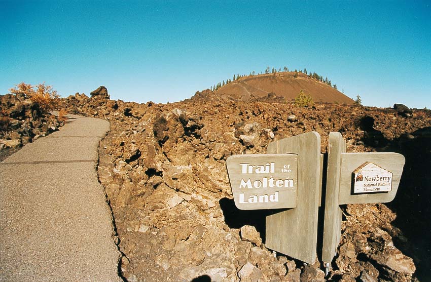
The beginning of the trail. It was a privilege for us to visit this wonderful place.

This is the way the solidified, cracked lava looks. It is of the "AA" type. It was released from the volcano about 7000 years ago, and covers nine square miles. Later pictures show the lava field from the top of the butte.

As was the case for the Pumice Desert at crater Lake, very little vegetation has been able to establish itself on these lava flows, even after 7000 years. But there is more here than at Pumice Desert. You can see some people walking the trail ahead of us.

A close-up view of the lave and its sparse vegetation. The Cascade Range appears in the background.

A sparser look at the lava.
Ahead to Trail of the Molten Land 2, Lava Butte
Back to East Side of Rim, Crater Lake
Back to Oregon 2002
Back to Photo Shows